
Captain Cook Monument Snorkeling and Volcanic Geology
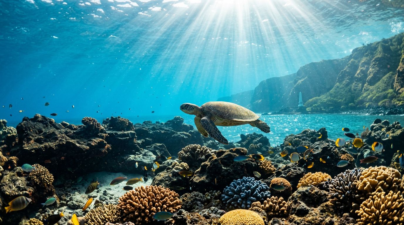
Captain Cook Monument snorkeling gives you more than clear water and colorful fish. Beneath your fins, you can see the exposed structure of a volcanic island, shaped by flowing lava, cooling basalt, wave erosion, and reef growth.
The dark ledges, underwater slopes, shallow shelves, and sandy pockets at Kealakekua Bay all have geological reasons. Once you understand those features, your snorkeling Big Island Hawaii experience becomes easier to read and far more memorable.
Kona Snorkel Trips takes you into this setting with guided excursions focused on safety, marine education, and respectful access to the reef. Before you enter the water, it helps to understand how the bay formed.
Kealakekua Bay began with shield-volcano lava
Hawaii Island is built from broad shield volcanoes. These volcanoes produce fluid basaltic lava, which can travel long distances before cooling. Over many eruptions, layer after layer of lava expanded the island and pushed its coastline farther into the Pacific.
Kealakekua Bay sits on the western side of Hawaii Island, where the slopes of Hualalai reach the ocean. Hualalai is one of the island’s five major volcanoes, and its lava flows shaped much of the Kona coast. The bay’s present shoreline developed through a mix of volcanic construction, coastal erosion, and changes in sea level.
That process took place over a long period. A single eruption didn’t carve the entire bay into its current shape. Instead, separate lava flows covered older surfaces. Some flows cooled with smooth, folded textures known as pahoehoe. Others formed rough, broken surfaces called aa. Wave action then wore down exposed rock and opened spaces along the coast.
Basalt often looks black, charcoal gray, or brown when dry. Underwater, the same rock can appear green, blue, or silver because water filters sunlight and algae cover the surface. Its color changes with depth, the angle of the sun, and the growth of marine life.
The rock also contains small openings called vesicles. Gas bubbles formed inside the lava while it cooled, leaving pockets in the hardened basalt. Those tiny spaces can collect sand, algae, and small invertebrates. Larger cracks create shelter for fish and other reef animals.
When you snorkel near the Captain Cook Monument, you are looking at the edge of a volcanic landform. The reef sits on that foundation, but the reef itself developed later.
Why the underwater terrain looks steep and broken
Kealakekua Bay has a sheltered shape, but its underwater terrain is far from flat. Submerged lava shelves continue outward from the coast, while cracks, slopes, and eroded faces interrupt the bottom. In some areas, the rock drops gradually. In others, you may see a sharper change in depth.
Lava behaves differently as it cools. A thick flow can form a broad, solid platform. A thinner flow may leave uneven ridges and channels. When lava reaches seawater, its outer surface cools quickly while hotter material continues moving behind it. This process can create rounded, bulbous forms often associated with pillow lava.
You won’t see every volcanic texture in one swim. However, you may notice rounded rock forms, angular blocks, dark walls, and smooth shelves within the same general area. Each feature records a different moment in the cooling and erosion of the coast.
Wave energy also affects what you see. Exposed points receive more force, so waves wear away weak zones and widen cracks. The bay provides protection from some open-ocean swell, allowing delicate reef communities to grow on stable rock. Still, wind and ocean conditions can change the water quickly.
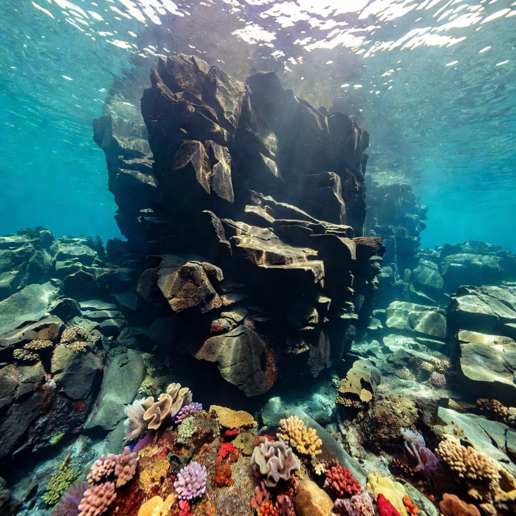
Submerged basalt creates ledges, cracks, and sheltered surfaces where reef life can develop.
As you move through the bay, look at how the bottom changes. A shallow rock shelf may lead toward a darker slope. A crack may open beneath an overhang. A patch of sand may fill a low point between older lava surfaces.
Those changes influence where fish gather, how currents move, and how comfortable you feel in the water. The geology is part of the snorkeling route, not background scenery.
Basalt gives coral a place to grow
Coral reefs need a hard surface where young coral colonies can attach. The stable basalt around Kealakekua Bay provides that surface. Over time, coral polyps build calcium carbonate skeletons, creating small colonies that expand across suitable sections of rock.
The reef doesn’t cover every inch of the volcanic bottom. Coral growth depends on light, water movement, depth, temperature, and the condition of the substrate. As a result, you may see dense coral in one area and exposed lava or sand nearby.
That contrast helps you understand the relationship between geology and biology. Lava creates the foundation, while coral and other organisms gradually add living structure. Fish then use the reef for food, shelter, and places to reproduce.
Hard coral heads can grow on older lava shelves. Small coral colonies may occupy cracks and shallow depressions. Algae can spread across smoother areas, while sea urchins graze along rock surfaces. The reef becomes a patchwork of life built on a volcanic base.
You may spot Hawaiian reef fish such as parrotfish, butterflyfish, and surgeonfish. Their feeding habits also shape the reef. Parrotfish scrape algae from rock with specialized teeth, while other fish pick food from the surface or search through crevices.
When you see a bright fish disappear behind a ledge, the rock has provided more than scenery. It has created a refuge. A rough basalt surface can support algae, small crustaceans, worms, and coral. Those organisms attract larger fish, which creates the layered food web you observe while snorkeling.
Kealakekua Bay’s protected marine environment makes careful observation especially important. The reef grows slowly, and careless contact can damage living coral even when the rock beneath it looks sturdy.
The volcanic rock is old, but the reef growing on it is alive and vulnerable.
How to read the reef while you snorkel
You don’t need a geology degree to recognize volcanic features underwater. Start by watching the shape of the bottom rather than looking only for fish.
A dark, smooth surface may indicate a relatively even lava shelf. A rough, jagged area can show broken aa lava or rock fractured by cooling and wave action. Rounded forms may reflect lava that cooled against seawater. Small holes and narrow cracks often hold algae or provide hiding places for juvenile fish.
Color can offer clues, too. Bare basalt usually appears dark. A green or brown coating may indicate algae. Pale areas can contain coral, sand, or exposed carbonate material. Bright colors often come from living organisms rather than the volcanic rock itself.
You may also notice that water moves differently around each feature. A narrow channel can accelerate a mild current. A large rock can create a calmer pocket behind it. A ledge may deflect water upward, carrying plankton and attracting small fish.
Keep your body position steady as you observe these details. Stay horizontal, use slow fin strokes, and avoid pushing off the bottom. Even a light kick can stir sand over nearby coral and reduce visibility for everyone around you.
The monument itself adds a historic and cultural dimension to the site. Captain James Cook arrived in Hawaii in 1778 and returned in 1779. He was killed at Kealakekua Bay in February 1779. The white monument on the shore at Ka’awaloa identifies the area associated with that event.
You can acknowledge that history without treating the site as a simple photo stop. The bay remains an important place for Native Hawaiian history and culture. Follow local guidance, respect restricted areas, and listen when your guide explains appropriate conduct near the monument and shoreline.
Why water clarity changes at Captain Cook
Clear water is one reason people choose to snorkel Big Island sites along the Kona coast. However, visibility at Captain Cook Monument can change with weather, ocean movement, sunlight, and recent rainfall.
Kealakekua Bay offers shelter compared with an exposed coastline. That protection can reduce the effect of some ocean swell, which helps maintain calm conditions inside the bay. It doesn’t block every source of movement. Strong winds can create surface chop, and larger swells can push water through the bay.
Rain also affects visibility. Water flowing over land can carry fine sediment into the ocean. Even when rain falls inland or earlier in the day, runoff may take time to reach coastal water. Sediment can settle in protected areas or remain suspended, creating a hazy layer.
Sunlight changes the underwater view throughout the day. A low sun angle can make the surface sparkle while leaving rock faces in shadow. Higher sunlight often reveals more texture on shallow ledges and coral heads. Clouds can soften the contrast but may also reduce the light reaching deeper reef areas.
Plankton and seasonal ocean conditions can affect clarity as well. A day with slightly reduced visibility can still offer excellent marine life viewing, especially near shallow rock and coral. Clear water is valuable, but it isn’t the only measure of a good snorkeling trip.
Ask about the current forecast before you choose your outing. A professional guide can explain whether wind, swell, current, and visibility suit your swimming ability. You should also be ready for the guide to adjust the route if conditions change.
How a guided tour helps you see the geology
A guided trip can connect the underwater view with the landscape above it. Instead of seeing a dark rock wall as an obstacle, you learn how its shape affects fish habitat, water movement, and coral growth.
Kona Snorkel Trips follows a “Reef to Rays” philosophy and offers small-group ocean adventures around the Kona coast. Lifeguard-certified guides focus on guest safety, marine education, and reef-safe practices. The company provides quality snorkeling equipment and gives you personal support before you enter the water.
For Captain Cook Monument snorkeling, that guidance matters because the bay combines open-water conditions, uneven volcanic terrain, and a protected marine environment. A guide can help you choose a comfortable entry, maintain distance from coral, and notice features you might otherwise swim past.
You can book a Captain Cook snorkeling tour with Kona Snorkel Trips to explore the Kealakekua Bay marine sanctuary with a professional crew. The company also limits the impersonal feel of crowded commercial outings by keeping the experience personal and education-focused.
Another company dedicated to this area is Captain Cook Snorkeling Tours. You can compare tour details, schedules, and access options before choosing the outing that fits your group.
If you want a guided experience with Kona Snorkel Trips, you can check availability for current departure times.
The right guide also helps you separate natural features from human impacts. A worn path, loose debris, or damaged coral may not belong to the original volcanic landscape. Learning that difference can change how carefully you move through the water.
Choose your Captain Cook outing with conditions in mind
Your snorkeling experience depends on more than the destination name. The boat, schedule, group size, water entry, and guide support all affect how much you can enjoy the geology and reef.
Before booking, ask practical questions about the trip:
- Does the route include the Captain Cook Monument area and Kealakekua Bay?
- How does the crew handle changing wind, swell, or current?
- What flotation equipment is available if you need extra support?
- How much time do you usually spend in the water?
- Will the guide explain the reef, volcanic features, and local history?
A boat trip can give you direct access to sections of the bay that are difficult to reach over land. It may also reduce the distance you need to swim before you begin observing the reef. Shore access involves different demands, including uneven ground, limited facilities, and a longer approach to the water in some locations.
Families should consider each swimmer’s comfort in the ocean. Children and less experienced swimmers may benefit from flotation support and close guide attention. Strong swimmers still need to respect current and avoid assuming that calm surface water means no movement below.
Couples and solo travelers may prefer a smaller group because you can hear the guide more easily and move at a comfortable pace. Larger groups should confirm how the operator manages different swimming abilities.
Timing can matter, but no schedule guarantees perfect conditions. Choose a company that explains its weather policy and makes safety decisions based on the actual ocean rather than a fixed itinerary.
For a Captain Cook and Kealakekua Bay trip with Kona Snorkel Trips, you can check avaialbility before your travel date.
Protecting a living reef on a volcanic coast
The basalt beneath Kealakekua Bay can survive wave impact for thousands of years. Coral colonies growing on that rock are much more fragile. A careless fin kick, handhold, or standing step can break living coral in seconds.
Keep your hands off the reef, even when a surface looks like bare stone. Coral, algae, and small organisms may cover the rock. You can float above it and observe without touching.
Use slow, controlled fin strokes. If you need to rest, use approved flotation support rather than standing on the bottom. Never take rocks, coral, shells, or other natural material from the bay.
Apply sunscreen before entering the water, and choose a mineral formula that follows current Hawaii regulations. A rash guard can reduce the amount of sunscreen you need. Keep food, drinks, and personal items secured so they don’t enter the ocean.
Feeding fish changes their behavior and can disturb the balance of the reef. Maintain a respectful distance from turtles and other wildlife. Give animals room to move, and don’t chase them for a closer photograph.
You also protect the site by following your guide’s instructions near the monument and marine sanctuary. Local rules can change, so check current guidance before your trip. Responsible snorkeling keeps the volcanic shoreline available for future visitors and preserves the reef communities that make the bay special.
What the landscape tells you about Captain Cook Monument snorkeling
When you look toward the steep Kona coastline, you see the upper part of a much larger volcanic structure. The land continues below the surface, where lava shelves, cooled flow textures, fractures, and eroded edges shape the seafloor.
Those features control where coral can attach and where fish can hide. They also influence current, visibility, and the route your guide chooses. The bay’s famous water clarity depends partly on this sheltered volcanic setting, while its rich marine life depends on the hard reef foundation.
You can make the experience more meaningful by taking a few moments to observe the sequence. First, notice the shape of the submerged rock. Then look for coral growing on stable surfaces. Watch how fish use cracks, ledges, and shaded areas. Finally, consider how waves continue changing the coast above and below water.
That approach works whether you’re planning snorkeling Big Island activities with your family, a romantic ocean outing, or a wider snorkeling Big Island itinerary. You don’t need to identify every rock type. You only need to pay attention to the connection between land, water, and life.
Conclusion
Captain Cook Monument snorkeling reveals a coastline built by basalt and refined by the sea. Volcanic flows created the hard foundation, erosion shaped the bay, and coral communities turned stable rock into living habitat.
When you understand that connection, every ledge and crevice has more meaning. Your best view of Kealakekua Bay comes with careful movement, respect for its history, and attention to the living reef beneath the volcanic coast.